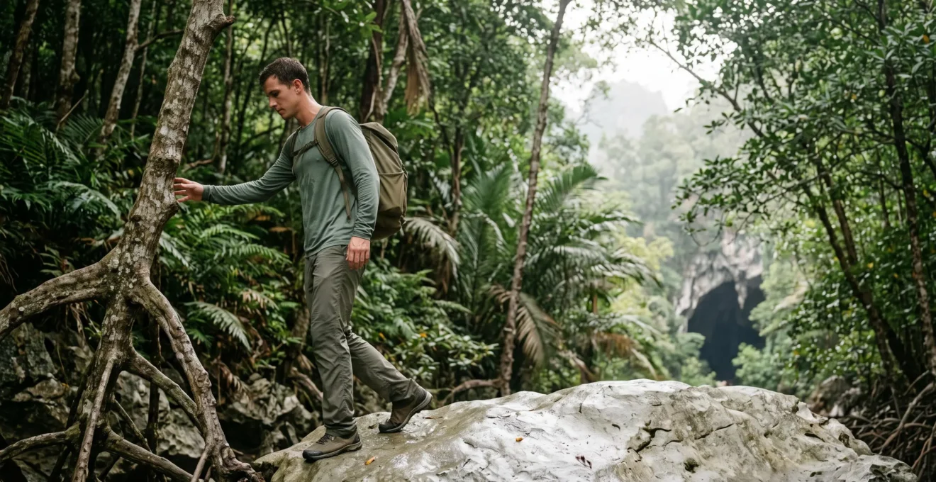
Your standard UK hiking fitness is an unreliable measure for Los Haitises; success depends on preparing for the jungle’s specific ‘effort multipliers’, not just the distance.
- Extreme humidity can reduce your physical power output by over 15%, making even short walks feel strenuous.
- Terrain consists of slippery clay, tangled roots, and sharp limestone, demanding balance and leg strength far more than a typical country walk.
Recommendation: Before you go, test yourself on a steep, muddy, and humid day in the UK. If a challenging 5km in those conditions leaves you breathless, you need to build specific strength and endurance for Los Haitises.
If you’re a moderately active hiker from the UK, your first thought when looking at a trail map for Los Haitises National Park might be one of confidence. A 5km or 10km trail? For someone accustomed to a weekend ramble through the Peak District or along the Cornish coast, it sounds like a pleasant afternoon stroll. This is the first, and most critical, miscalculation. The distance you see on the map is a poor indicator of the actual physical demand. The real challenge isn’t the length of the trail, but the environment’s relentless ‘effort multipliers’.
Most travel guides give you the generic advice: « it’s hot and humid, » « wear good shoes. » But this fails to provide a genuine fitness benchmark. It doesn’t translate the abstract challenge into a tangible self-assessment you can perform back home. The key to knowing if you’re fit enough for Los Haitises isn’t about how far you can walk, but how your body copes with a specific combination of extreme humidity, unstable terrain, and sensory overload. Your fitness, honed in the cool, temperate climate of the UK, needs to be re-calibrated against the unique physical taxes of a tropical karst jungle.
This guide is your fitness assessor. We will move beyond the platitudes to give you concrete benchmarks and a realistic understanding of the physical toll. We’ll break down the specific environmental factors, compare different trail types, and provide an actionable framework to help you honestly assess if your current fitness level is a good match for the adventure, or if some targeted preparation is in order.
To help you navigate the specific physical assessments in this guide, the following summary outlines the key areas we will cover. Each section is designed to help you benchmark your fitness against the real-world demands of hiking in this unique Dominican landscape.
Table of Contents: A Fitness Assessment for Los Haitises
- Why Do Los Haitises Trails Exhaust People Who Comfortably Walk 10km Daily?
- Los Haitises Coastal Mangrove Trails or Inland Forest Hikes: Which Is Easier?
- What Should You Pack for Los Haitises Hikes That Beach Gear Doesn’t Cover?
- The Safety Risk of Hiking Los Haitises Trails Without an Official Guide
- When Are Los Haitises Trails Least Muddy and Most Accessible?
- Why Is Samaná Better for Adventure Seekers Than Punta Cana’s Flat Coastline?
- Los Haitises or Cordillera Central: Which Offers Deeper Rainforest Exploration?
- What Adventure Activities in Samaná Go Beyond the Standard Whale Watching Tours?
Why Do Los Haitises Trails Exhaust People Who Comfortably Walk 10km Daily?
The primary reason a fit UK walker can feel completely drained on a short Los Haitises trail is a concept we’ll call the ‘Humidity Tax’. In the UK, your body cools itself efficiently through sweat evaporation. In the saturated air of a tropical jungle, this process breaks down. Your body still produces sweat, but it can’t evaporate, leading to a rapid increase in core body temperature and cardiovascular strain. You are essentially working much harder just to stay cool, even before you factor in the physical exertion of walking. This isn’t a feeling; it’s a measurable physiological impairment.
To put a number on it, a recent exercise physiology study found that in conditions of very high humidity, athletes can experience a significant performance drop. The research confirms that a power output reduction of around 16% is common. For a hiker, this means your muscles have 16% less power available for climbing, balancing, and pushing forward. That 10km walk you breeze through at home suddenly has the physiological cost of a 12km or 13km trek, and that’s before considering the terrain. It’s a compounding effect that turns a simple walk into an endurance event.
An expert study into this very phenomenon explains the science in stark terms. As researchers from the Scandinavian Journal of Medicine & Science in Sports note:
These data indicate that reductions in evaporative potential and efficiency with elevated humidity exacerbate thermal and cardiovascular strain during self‐paced cycling in the heat, resulting in marked performance impairments.
– Bright et al., Scandinavian Journal of Medicine & Science in Sports (via PMC)
In simple terms, your heart has to work overtime, and your performance plummets. This is the central ‘effort multiplier’ that you must factor into your fitness assessment. A good benchmark is to consider how you feel on the rare, intensely humid summer days in the UK. If a short, brisk walk leaves you feeling unusually tired and sticky, you’ve had a small taste of the Humidity Tax you’ll pay in Los Haitises.
Los Haitises Coastal Mangrove Trails or Inland Forest Hikes: Which Is Easier?
Not all hikes in Los Haitises are created equal. The perceived difficulty varies dramatically depending on whether your tour focuses on the coastal mangrove systems or ventures into the inland karst forest. For the less-fit hiker, or those concerned about endurance, understanding this distinction is crucial. The ‘coastal’ trails are often short walks from a tour boat to a Taino cave entrance, frequently on flat, man-made boardwalks. They are designed for accessibility and minimise physical challenge, focusing instead on the historical and geological highlights.
The ‘inland’ forest hikes, however, are a different proposition entirely. These are true treks through dense jungle. While the overall elevation change might not seem huge on a map, the terrain consists of short, sharp, and very steep ascents and descents over slippery clay and a web of gnarled tree roots. The physical demand here shifts from pure cardiovascular endurance to a need for leg strength, balance, and agility. Each step requires conscious placement to avoid a slip or a turned ankle. This constant micro-management of your footing is mentally and physically taxing in a way that walking on a prepared path is not.
The table below, based on typical tour descriptions like those found on platforms such as Viator where various expeditions are detailed, breaks down the key differences. It provides a clear framework for assessing which type of excursion aligns best with your fitness level and adventure appetite.
| Criteria | Coastal Mangrove Trail | Inland Forest Hike |
|---|---|---|
| Typical duration | Short boat-to-cave walk (often boardwalked) | Multi-hour guided trek through jungle |
| Terrain | Mostly flat, uneven with roots, water-logging risk | Short but steep elevation changes, slippery clay after rain |
| Access | Reached by boat, tied to tour schedules | Requires a dedicated guided tour on foot |
| Guaranteed highlight | Taino pictograph caves | Deeper immersion in primary forest and birdlife |
What Should You Pack for Los Haitises Hikes That Beach Gear Doesn’t Cover?
It’s a common mistake for visitors to the Dominican Republic to assume their beach bag essentials will suffice for a « day trip » to a national park. However, as travel writers at Explorers Away point out, Los Haitises offers a glimpse into a completely different, untouched side of the country compared to the developed resort areas. Your packing list must reflect this shift from a controlled, manicured environment to a wild, unpredictable one. Your flip-flops, swimming trunks, and a single towel are simply not adequate for a jungle hike.
The primary consideration is protection. You are moving from an open, sun-drenched beach to a dense, shaded, and damp forest floor teeming with life. This requires a fundamental shift in your attire from exposure to coverage. Lightweight, quick-drying long trousers and long-sleeved shirts are non-negotiable. They serve a dual purpose: protecting your skin from the scratches of dense undergrowth and, more importantly, providing a physical barrier against the myriad of biting and stinging insects that inhabit the jungle. The air is thick with mosquitoes and other unseen critters that a simple spritz of DEET won’t always deter.
Case Study: Why Wildlife Density Demands Protective Clothing
A typical guided hiking itinerary through the park’s interior highlights the incredible biodiversity. Guides on tours such as the Los Haitises hiking activity from Sabana de la Mar actively point out the rich fauna, encouraging guests to « look out for the small solenodon… and keep your eyes peeled for the parrots, pelicans and kingbirds. » This density of wildlife, while a major attraction, directly correlates to a high density of insects and a complex, thorny ecosystem. Your clothing is your first and best line of defense, allowing you to enjoy the wildlife without becoming its next meal.
Footwear is the other critical upgrade. The soft sand of the beach is replaced by a treacherous combination of slippery clay, sharp-edged limestone (karst), and a network of slick tree roots. Your beach sandals or casual trainers lack the two things you need most: deep-lugged grip and ankle support. A proper pair of hiking shoes or boots, already broken in, is essential to prevent the slips and ankle rolls that are a constant risk on these trails.
Action Plan: Your Jungle Hiking Gear Checklist
- Footwear Audit: Do you own shoes with deep, muddy-terrain grip and ankle support? If not, acquire and break them in. Standard trainers are not sufficient.
- Clothing Selection: Inventory your quick-dry, lightweight long-sleeved tops and trousers. Cotton is a poor choice as it holds moisture; synthetics or merino wool are ideal.
- Waterproofing: Secure a proper dry bag for electronics (phone, camera). The humidity and chance of rain are constant threats. A waterproof backpack or a rain cover is a wise addition.
- Insect & Sun Defence: Pack high-DEET insect repellent AND a physical barrier like long clothing. A wide-brimmed hat and sunscreen are still needed for open areas or boat travel to the trail.
- Hydration System: A standard 500ml bottle is insufficient. Plan for at least 1.5-2 litres of water per person, ideally in a hydration pack for easy access without stopping.
The Safety Risk of Hiking Los Haitises Trails Without an Official Guide
The argument for hiring an official guide in Los Haitises goes far beyond the simple risk of getting lost in an unmarked jungle. While the trails are indeed a confusing labyrinth, the most significant danger lies in what you don’t know about the environment. The forest is not a benign collection of trees; it’s a complex ecosystem filled with flora and fauna that can be harmful if interacted with improperly. A guide’s value is not just in knowing the path, but in knowing what to avoid along it.
Consider the Manchineel tree (Hippomane mancinella), common in Caribbean coastal parks like this. To the untrained eye, it looks like any other tree, sometimes bearing a small, apple-like fruit. However, it is one of the most toxic trees in the world. Every part of it is dangerous. Standing under it during a rain shower can cause your skin to blister as the water running off the leaves becomes caustic. The fruit is famously lethal. As the Encyclopaedia Britannica soberly states, consumption of the fruits is potentially lethal and can cause severe blisters in the mouth and esophagus. A local guide will spot a Manchineel from a distance and steer you clear, a life-saving piece of knowledge you simply do not possess.
This is just one example. The forest contains numerous other plants that can cause severe skin irritation, as well as venomous snakes and insects. Furthermore, guides are trained in first aid and have established communication protocols for emergencies in areas with no mobile phone signal. They carry the necessary equipment and know the evacuation points. Attempting a hike without a guide is not an act of adventurous independence; it is an act of reckless endangerता. You are not just paying for a navigator; you are investing in a risk-mitigation expert for a high-risk environment.
When Are Los Haitises Trails Least Muddy and Most Accessible?
The short, candid answer to « When are the trails least muddy? » is almost never. The defining characteristic of Los Haitises is its incredible humidity and rainfall, which creates the lush, verdant landscape that attracts visitors in the first place. The park exists within a humid subtropical climate zone, and the very name « Haitises » is a Taino word meaning « hilly land, » a reference to the steep limestone formations that trap moisture. Understanding this is key to managing your expectations: you are going to a rainforest. Mud is not a possibility; it is a certainty.
To put this into perspective, the park receives an immense amount of precipitation. Official data indicates the region gets about 2,000 mm (79 inches) of rain per year. For a UK-based reference, that is more than double the annual rainfall of Manchester and nearly three times that of London. This constant supply of water keeps the ground perpetually saturated. The soil, a heavy clay, does not drain quickly. As a result, even if it hasn’t rained for a day or two, the trails will retain significant moisture, creating slick, slippery, and often deep mud pits.
However, you can slightly improve your odds by timing your visit. The Dominican Republic’s « dry season » typically runs from December to April. During these months, the frequency and intensity of downpours are reduced, though not eliminated. This is your best window for trails that are merely ‘very muddy’ as opposed to ‘impassable quagmires’. Conversely, the peak of the wet season, from May to November (and especially August-September, which is also hurricane season), will see trails at their most challenging. If you are particularly concerned about your ability to handle extremely slippery conditions, booking your trip for January or February is your most strategic choice. But be prepared: « least muddy » in Los Haitises still means you will need waterproof hiking boots with excellent grip.
Why Is Samaná Better for Adventure Seekers Than Punta Cana’s Flat Coastline?
For the UK traveller whose idea of adventure involves more than just a perfect beach, the Samaná Peninsula offers a profoundly different experience to the popular resorts of Punta Cana. The fundamental difference is one of topography. Punta Cana is renowned for its long, flat, idyllic stretches of white sand—perfect for relaxation, but offering little in the way of physical challenge or dramatic landscapes. Samaná, in contrast, is a region defined by its rugged, mountainous terrain that collides dramatically with the ocean.
This is a landscape of verticality and exploration. As the official Dominican Republic tourism board highlights, the adjacent Los Haitises National Park is famous for its 30-meter (98-foot) high rock formations (mogotes) that jut out of the water and land. The entire peninsula is a network of steep hills, hidden waterfalls like the famous El Limón, and secluded coves that are often only accessible by boat or a strenuous hike. This terrain is the raw material for adventure. It provides the gradients for challenging hikes, the cliffs for stunning viewpoints, and the jungle canopy for ziplining.
This inherent wildness means the region is less developed, a key point noted by travel experts who describe it as a « largely undeveloped and supremely beautiful » area « known for its rich biodiversity and dramatic landscapes. » While Punta Cana offers a polished, all-inclusive version of paradise, Samaná presents a more authentic, raw version. It requires more effort from the visitor but rewards that effort with a deeper sense of discovery. For the adventure seeker, the choice is clear: one offers passive relaxation on a flat coastline, while the other offers active engagement with a dynamic, vertical landscape.
Los Haitises or Cordillera Central: Which Offers Deeper Rainforest Exploration?
For the serious hiker looking to truly immerse themselves in the Dominican wilderness, a crucial distinction must be made between the jungle exploration offered in Los Haitises and the epic expeditions available in the Cordillera Central, the country’s central mountain range. While both offer « rainforest, » they represent two vastly different scales of adventure and require entirely different levels of fitness and commitment. Los Haitises, for all its ruggedness, is fundamentally an accessible, low-altitude day-trip destination.
The Cordillera Central, on the other hand, is the domain of multi-day, high-altitude trekking. It is home to the highest peaks in the entire Caribbean, culminating in Pico Duarte. Recent GPS surveys have confirmed the staggering scale, placing the summit at a precise altitude of 3,101.1 meters. Hiking here is not a casual walk; it is a serious mountaineering endeavor, often taking 3 to 4 days and requiring specialized gear, altitude acclimatization, and a level of endurance far beyond what is needed for Los Haitises. The ecosystem changes from humid coastal jungle to cool, high-altitude cloud forests and pine groves. It is, without question, the « deeper » exploration.
This comparative table clarifies the choice. Los Haitises offers a fantastic, concentrated dose of wild jungle that is challenging but manageable for a strong intermediate hiker. The Cordillera Central is a true expedition for the advanced trekker seeking a profound, multi-day test of endurance. Choosing between them is a matter of honestly assessing your fitness, your available time, and the very definition of « adventure » you are seeking.
| Criteria | Los Haitises | Cordillera Central (Pico Duarte) |
|---|---|---|
| Ecosystem | Humid, low-altitude coastal jungle | High-altitude, cool cloud forest with pine groves |
| Format | Accessible day-trip exploration | Multi-day expedition |
| Typical trek length | A few hours on foot | 40 to 108+ km over 3 to 14+ days |
| Fitness level required | Strong intermediate | Advanced, multi-day endurance and altitude tolerance |
Key Takeaways
- Your fitness is relative; extreme humidity in Los Haitises acts as a ‘tax’ that significantly reduces your normal performance.
- Inland forest trails demand more agility and leg strength due to steep, slippery terrain, whereas coastal mangrove trails are flatter and more accessible.
- Safety is paramount; the non-obvious dangers of the jungle, like toxic plants, make an official guide an essential part of your risk management, not a luxury.
What Adventure Activities in Samaná Go Beyond the Standard Whale Watching Tours?
While the magnificent humpback whales that visit Samaná Bay from January to March are an undeniable highlight, the region’s adventure potential extends far beyond this seasonal spectacle. The same rugged topography that defines the peninsula—its steep hills, deep-cut rivers, and numerous waterfalls—creates a natural playground for a variety of adrenaline-fueled activities. For the visitor seeking a physical challenge, Samaná offers a robust circuit of options that engage with the landscape in a more intimate and demanding way.
One of the most established and exciting options is canyoning (or ‘cascading’). This sport involves navigating a river gorge by a combination of hiking, swimming, sliding down natural water chutes, and rappelling down waterfalls. The area around the famous El Limón waterfall is particularly well-suited for this, with several local operators offering guided canyoning tours. This is a full-body workout and a thrilling way to experience the cool, pristine waters of the jungle’s interior, far from the coastal heat.
Beyond canyoning, the options are plentiful. The hilly interior is crisscrossed with trails perfect for horseback riding, offering a different way to access remote waterfalls and viewpoints. The extensive coastline, with its secluded coves and clear waters, is ideal for sea kayaking and paddleboarding, providing a test of upper-body endurance and a unique perspective on the dramatic cliffs. Ziplining through the jungle canopy offers a rush of speed, while exploring the network of caves, both on land and accessible by water, appeals to the spelunker. The existence of established tours for activities like canyoning near El Limón confirms that the adventure infrastructure is already in place, waiting for travelers ready to look beyond the whale’s tail.
This wide array of activities proves that Samaná is not a one-trick pony. It is a comprehensive adventure destination where the main challenge is simply choosing which thrill to pursue next. The key is to look at the landscape and see the potential for interaction: a river is a path, a waterfall is a challenge, and a hill is a viewpoint waiting to be earned.
The final step, therefore, is not to book a tour, but to perform an honest self-assessment. Use the benchmarks in this guide to evaluate your readiness. Can you handle a steep, muddy trail on a humid day? Is your gear suited for a jungle, not a beach? By answering these questions honestly, you transform a potential holiday mishap into a well-prepared and deeply rewarding adventure into one of the Caribbean’s last great wildernesses.