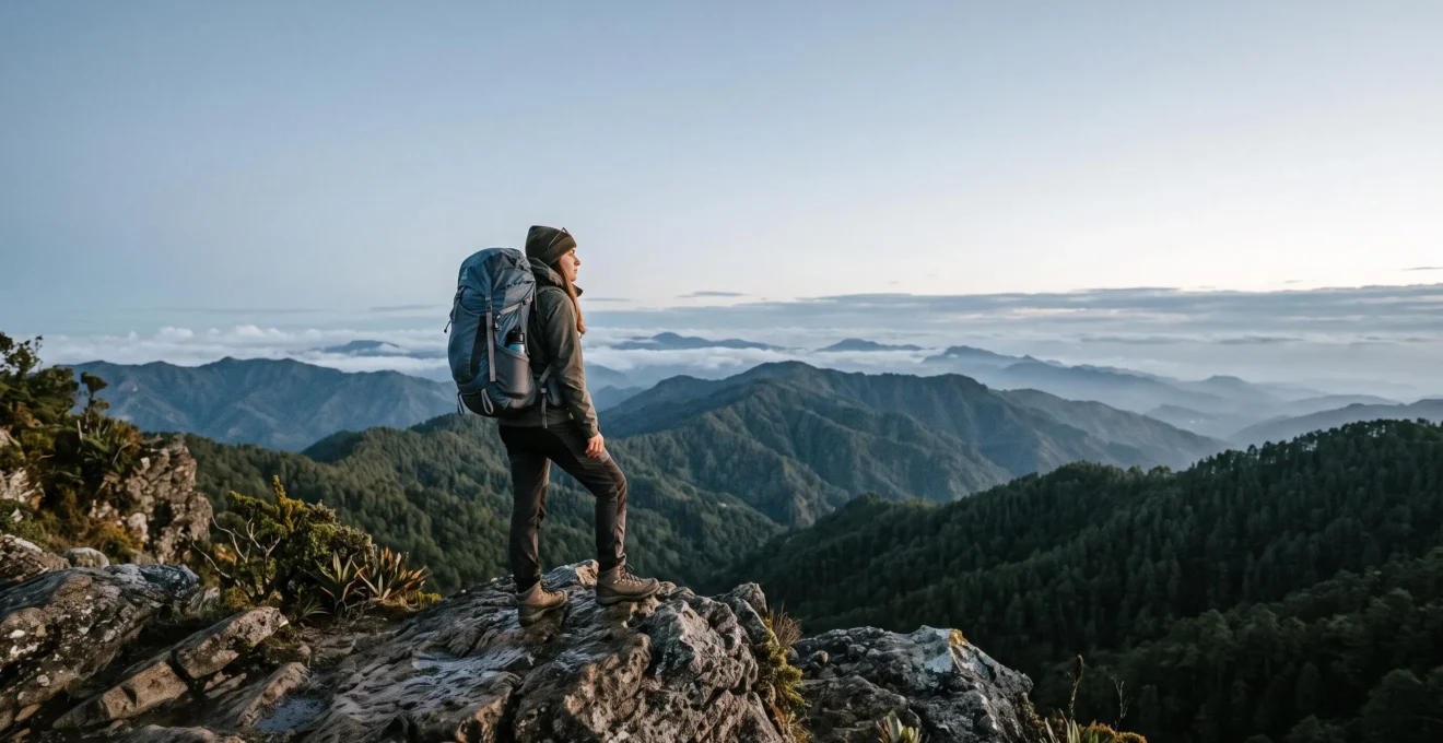
Summiting Pico Duarte is less about your peak gym performance and more about your specific ‘mountain endurance’—the ability to sustain moderate effort over several days with less oxygen.
- Altitude dramatically reduces your aerobic capacity, making even simple tasks feel difficult, regardless of your sea-level fitness.
- The most common failure point is poor pacing, especially for fit hikers who push too hard on the first day, leading to avoidable altitude sickness.
Recommendation: Before you book, assess your ability to complete back-to-back 15km hikes in UK hills with a 10kg pack. If you can do this comfortably, you have the right foundation to train for Pico Duarte.
You can comfortably manage a 10-mile hike in the Peak District and your weekly cardio sessions are non-negotiable. So, when you see photos of Pico Duarte’s summit—the highest point in the entire Caribbean at a staggering 3,087 metres—a logical question forms: « Am I fit enough for that? » The standard answer you’ll find is a vague « you need to be in good shape. » This is unhelpful. It fails to distinguish between the fitness to run a 10k and the specific resilience needed to ascend through changing microclimates for two or three consecutive days.
The truth is, Pico Duarte is a unique test. It doesn’t demand explosive power or sprinting speed. It demands a different, often misunderstood, type of fitness: mountain endurance. This is your body’s ability to perform efficiently with less oxygen, manage energy over long durations, and recover overnight in basic conditions. Many exceptionally fit athletes fail on high-altitude treks not from a lack of strength, but from a lack of pacing discipline and a misunderstanding of how their body functions above 2,500 metres.
This guide acts as your pre-expedition fitness assessment. We will move beyond platitudes and dissect the real physical demands of the trail. We’ll analyse why your VO2 max at sea level is an unreliable predictor of success, which routes are logistically sound, and the critical pacing errors that sideline even seasoned hikers. The goal is to replace uncertainty with a clear, honest benchmark, enabling you to decide if this is the right challenge for you and how to specifically prepare for it.
This article provides a structured assessment of the fitness, planning, and environmental factors involved in a successful Pico Duarte trek. The following sections break down each component to give you a complete picture of the challenge.
Summary: Your Pico Duarte Fitness and Logistics Assessment
- Why Does Pico Duarte’s Altitude Cause Breathlessness Even for Fit Hikers?
- La Ciénaga, Mata Grande, or Sabaneta: Which Pico Duarte Route Is Least Challenging?
- Guided Group or Independent Climb: Which Pico Duarte Option Is Safer for Beginners?
- The Pacing Mistake That Causes Altitude Sickness on 60% of Pico Duarte Climbs
- When Is Pico Duarte Safest to Climb With Minimal Rain and Clearest Views?
- Why Do Los Haitises Trails Exhaust People Who Comfortably Walk 10km Daily?
- Why Is Jarabacoa 8°C Cooler Than Punta Cana Despite Being in the Same Country?
- Why Should Beach-Focused Travellers Visit Jarabacoa’s Mountain Trails?
Why Does Pico Duarte’s Altitude Cause Breathlessness Even for Fit Hikers?
The primary reason Pico Duarte challenges even fit individuals is not the steepness of the trail, but the physiological impact of its altitude. At 3,087 metres (10,128 feet), the air pressure is significantly lower than at sea level. While the percentage of oxygen remains 21%, the lower pressure means you take in fewer oxygen molecules with each breath. Your body is suddenly running on a fuel-deprived engine. This creates an oxygen debt that forces your heart and lungs to work much harder to deliver the same amount of oxygen to your muscles, resulting in breathlessness, a rapid pulse, and fatigue that feels disproportionate to the effort exerted.
Your sea-level fitness, often measured by VO2 max (the maximum rate of oxygen consumption), becomes a poor guide. The effect is dramatic; a military medical research review found that VO2max was 40% lower at an altitude of 6,022 m. While Pico Duarte is not that high, the principle holds: your aerobic performance is significantly compromised. You may be able to run a half-marathon at home, but on the trail to La Compartición, you might find yourself gasping for air after a short, gentle incline. This is not a sign of poor fitness, but a normal physiological response to a hypoxic (low oxygen) environment.
Crucially, a high level of fitness does not grant immunity to altitude’s effects. In fact, it can sometimes be a liability if it leads to overconfidence. As one high-altitude trekking expert notes, raw aerobic power is not the deciding factor:
However: a higher VO2 max does not necessarily mean that you will perform well at altitude or avoid altitude sickness.
– Ian Taylor, Ian Taylor Trekking
This is why pacing and acclimatisation are far more critical than raw power. The goal is to give your body time to make the necessary physiological adjustments, such as producing more red blood cells, rather than trying to power through the oxygen deficit.
La Ciénaga, Mata Grande, or Sabaneta: Which Pico Duarte Route Is Least Challenging?
Choosing the right route for Pico Duarte is a critical decision that directly impacts the physical demand and duration of your trek. While no route is « easy, » they offer vastly different challenges in terms of distance and time commitment. For a first-time climber or someone concerned about their mountain endurance, the choice is clear. The vast majority of trekkers use the route starting from La Ciénaga de Manabao, which represents the most balanced and logistically straightforward option.
The other main routes, starting from Mata Grande or San Juan de la Maguana (via Sabaneta), are expeditions for the truly dedicated. They are significantly longer, often taking five to six days, and cover much more ground. They are less-travelled, meaning trail conditions can be more unpredictable and logistics more complex. The La Ciénaga route, by contrast, is a well-established trail with clear overnight stopping points at the La Compartición base camp.
A direct comparison of the primary routes, based on data from mountaineering communities, highlights the significant difference in demands. The La Ciénaga route is a strenuous multi-day trek, but the alternatives are in another league of difficulty entirely, as a comparative analysis of the main access routes shows.
| Route | Approx. Distance (round trip) | Elevation Gain | Typical Duration |
|---|---|---|---|
| La Ciénaga | ~40.7 km (25.3 mi) | ~1,977 m (one-way ascent) | 2–3 days |
| Mata Grande | 96 km (60 mi) | Not specified | 5–6 days |
| Sabaneta | 96 km (60 mi) | 3,802 m | 6–7 days |
For a UK hiker with solid fitness but no high-altitude experience, the La Ciénaga route is the only one to consider. It offers the « easiest » logistical framework, allowing you to focus on the physical challenges of altitude and terrain over a manageable two or three-day period. Even so, do not underestimate it; hikers consistently describe the 20km+ trail as an extremely demanding challenge, especially the steep final ascent from La Compartición to the summit.
Guided Group or Independent Climb: Which Pico Duarte Option Is Safer for Beginners?
When planning a Pico Duarte trek, the question isn’t whether to hire a guide, but rather *which* guide to hire. For safety, environmental, and legal reasons, an independent climb is not an option. Park regulations are clear: hiring a certified guide is mandatory for hiking Pico Duarte within the Armando Bermúdez National Park. This rule is in place to protect both the delicate ecosystem and the hikers themselves, many of whom are unprepared for the mountain’s rapidly changing weather and challenging terrain.
A good guide is your single most important asset on the mountain. They are not just navigators; they are your lifeline. An experienced local guide will manage the pace to prevent altitude sickness, handle all logistics (including park permits and mules for carrying gear), cook meals, and make critical safety decisions if the weather turns. They understand the mountain’s rhythm and can spot early signs of exhaustion or illness in their clients. This relationship, built on trust and expertise, is the foundation of a safe and successful summit attempt.
However, not all guides are created equal. The popularity of the trek has led to a wide range of services, from highly professional tour operators to individuals offering budget trips with questionable credentials. Choosing poorly can lead to a disastrous and dangerous experience, stripping away the safety net you’re paying for. A poorly vetted guide might lack first-aid knowledge, mismanage food supplies, or be unable to provide crucial information about the trail ahead.
The lady lied to us constantly, didn’t know the route so she couldn’t give us much trail information to prepare for. She also skipped our breakfast, lunch and on the second day tried to skip dinner.
For a beginner, the safest option is to book through a reputable, well-reviewed tour company based in Jarabacoa. While slightly more expensive, they provide vetted, certified guides, reliable equipment, and a proven safety record. This removes the guesswork and ensures your focus can remain on the physical challenge, confident that the logistics are in expert hands.
The Pacing Mistake That Causes Altitude Sickness on 60% of Pico Duarte Climbs
The single most common mistake that derails a Pico Duarte attempt is not a lack of fitness, but a failure of pacing discipline. This is especially true for fit hikers. You arrive at the trailhead feeling strong, and the initial, gently ascending path feels easy. Your instinct, honed by years of pushing yourself in the gym or on local trails, is to set a brisk pace. This is a critical error. By « jack-rabbiting » up the first few kilometres, you ascend too quickly for your body to acclimatise, and you virtually guarantee a brutal encounter with Acute Mountain Sickness (AMS) later in the day or on day two.
Counter-intuitively, your high level of fitness can work against you. You feel good, so you go fast, out-climbing your body’s ability to adapt. In contrast, a less « fit » person who is forced to go slowly from the start may fare much better. This isn’t just anecdotal; research suggests that endurance trained athletes with high VO2max may actually be at an increased risk for AMS because their physical capacity allows them to ascend too rapidly. They push into an oxygen-deprived state faster than their physiology can handle.
The correct strategy is to adopt a deliberately slow, almost frustratingly so, « mountaineer’s shuffle » from the very first step. Your guide will likely enforce this, but you must embrace it mentally. The goal for day one is not to arrive at the La Compartición camp quickly, but to arrive with minimal physiological stress, having given your body the maximum time possible to begin adjusting. Your success on summit day is determined by how well you manage your energy on day one. Before committing to the trek, conduct an honest self-assessment of your mountain endurance and discipline.
Your 5-Point Mountain Endurance Self-Audit
- Cardio Baseline: Can you comfortably sustain 60 minutes of moderate, Zone 2 cardio (e.g., brisk walking on a treadmill incline, steady cycling) three times per week without feeling exhausted?
- Loaded Carry Test: Can you complete a 15km (9-10 mile) hike on varied UK terrain, like the Brecon Beacons or Lake District, carrying a 10kg (22lb) backpack without excessive next-day muscle soreness?
- Consecutive Day Simulation: Can you perform back-to-back long walks (e.g., 12km on Saturday and 12km on Sunday) to test your recovery, joint resilience, and energy management?
- Pacing Discipline Check: During your next long training hike, can you consciously maintain a pace slow enough to hold a conversation for the first hour, even when you feel you could go much faster?
- Gear & Fueling Plan: Have you tested your hiking boots over a long distance to confirm no blisters, practised with your layering system, and identified snacks that work for you during sustained exercise?
If you can tick these boxes, you have the right foundational fitness. The final piece of the puzzle is the mental strength to respect the mountain and control your pace.
When Is Pico Duarte Safest to Climb With Minimal Rain and Clearest Views?
Timing your Pico Duarte expedition is just as important as your physical training. The Caribbean’s weather patterns mean that choosing the right month can be the difference between a triumphant summit with panoramic views and a gruelling, rain-soaked slog with zero visibility. The key is to aim for the heart of the Dominican Republic’s dry season, which offers the most stable and favourable conditions for a multi-day mountain trek.
The optimal window for climbing Pico Duarte is from December to March. During these months, the country experiences less rainfall, lower humidity, and more sunshine, especially in the mountainous interior. This translates to safer trail conditions—less mud and fewer slick rocks—and a much higher chance of the crystal-clear, 360-degree views that make the summit so rewarding. The nights will be cold, often dropping to near freezing or below at the summit, but the days are typically bright and pleasant for hiking.
This period is the peak season for a reason. Unsurprisingly, trail data shows that February is the most popular time of year for hikers on the main La Ciénaga route, as it sits squarely in the middle of this prime weather window. Attempting the climb during the wetter months (May to November) is highly discouraged. Heavy rains can make trails treacherous, increase the risk of hypothermia, and all but guarantee that your summit view will be a wall of thick cloud.
Booking your trek during the dry season requires advance planning, especially if you’re aiming for January or February. Here are some key preparation tips for timing your climb:
- Book in Advance: Reputable guides and tour agencies get booked up months ahead for the peak season. Secure your spot as soon as you’ve decided on your dates.
- Acclimatise in Jarabacoa: Plan to spend at least one night in the town of Jarabacoa (elevation ~530m) before starting your trek. This gives your body a gentle head start on acclimatisation.
- Pack for Four Seasons: The weather can change in an instant. Your pack must include layers for warm, sunny hiking, as well as thermal clothing, a waterproof jacket, a hat, and gloves for the frigid temperatures at the summit and camp.
- Final Weather Check: Check the mountain-specific weather forecast with your guide just before you depart. Be prepared to be flexible.
Why Do Los Haitises Trails Exhaust People Who Comfortably Walk 10km Daily?
To fully appreciate the unique challenge of Pico Duarte, it helps to understand the concept of « terrain tax »—the extra energy demanded by the Dominican Republic’s environment. A perfect case study is Los Haitises National Park. Visitors who can easily walk 10km on a flat park path back home often find themselves surprisingly exhausted after just a few kilometres on a jungle trail here. The reason is a combination of two factors rarely encountered on a typical UK walk: extreme heat and humidity, and punishingly uneven ground.
Even during the dry season, the coastal lowlands of Los Haitises are a cauldron of humidity. With park climate data showing that temperatures range from 25°C to 30°C, your body is constantly working overtime just to cool itself down through sweating. This saps energy and dehydrates you far more quickly than in a temperate climate. The air is so thick with moisture that sweat doesn’t evaporate efficiently, further hindering the cooling process. This oppressive humidity is a major energy drain before you’ve even factored in the trail itself.
Secondly, the trails are not paved paths. They are a chaotic network of gnarled tree roots, slick limestone, and pockets of deep mud. Every step requires conscious placement and the use of stabiliser muscles in your legs and core that are rarely engaged during a normal walk. This constant need for balance and micro-adjustments is a significant, hidden workout. It’s the physical « terrain tax » you pay for every metre you advance.
We soon walked past the furthest point I had previously hiked on the trail and it became rocky, muddy in spots and steep… it being mid day it was hot and humid.
While Pico Duarte’s trail is in a pine forest and cooler, the principle of terrain tax still applies. The path is rocky, can be muddy, and is unrelentingly uneven. Understanding the exhaustion of Los Haitises helps you respect that a kilometre on a Dominican trail is not the same as a kilometre back home.
Why Is Jarabacoa 8°C Cooler Than Punta Cana Despite Being in the Same Country?
For many UK travellers, the Dominican Republic is synonymous with the sweltering, humid heat of its coastal resorts like Punta Cana. This makes the crisp, cool air of Jarabacoa, the gateway town to Pico Duarte, a genuine shock. It’s common for the temperature in Jarabacoa to be 8-10°C cooler than on the coast, a climatic difference that feels like stepping into another country entirely. This isn’t magic; it’s a fundamental principle of atmospheric science known as the adiabatic lapse rate.
In simple terms, as air rises, it expands due to lower atmospheric pressure. This expansion requires energy, which the air takes from itself in the form of heat. The result is that for every 1,000 metres you ascend, the temperature drops by approximately 6.5°C to 9.8°C, depending on the humidity. Punta Cana sits at sea level. Jarabacoa sits at an elevation of around 530 metres (1,739 feet) in the foothills of the Cordillera Central. This elevation difference alone accounts for a significant temperature drop. The La Compartición campsite on the Pico Duarte trek is at 2,438 metres (8,000 feet), and the summit is at 3,087 metres, resulting in the near-freezing temperatures experienced at night.
This elevation effect creates two completely different worlds within a few hours’ drive. The coast is a tropical ecosystem of palm trees and mangroves, defined by heat and humidity. The Cordillera Central, by contrast, is a temperate zone of pine and broadleaf forests, defined by cool nights, lower humidity, and misty mornings. This dramatic shift is what allows for the « Dominican Alps » to exist in the heart of the Caribbean.
Understanding this simple meteorological fact is crucial for anyone planning a Pico Duarte trek. It underscores the need to pack for multiple climates: beachwear for the coast, and true mountain gear, including thermal layers and warm hats, for the highlands. It also explains why spending a day or two in Jarabacoa before the trek is not just pleasant, but a practical first step in acclimatising to the altitude and cooler conditions you will face higher up.
Key Takeaways
- Your success on Pico Duarte depends on ‘mountain endurance’—sustained, multi-day effort with less oxygen—not just your sea-level cardio fitness.
- The La Ciénaga route is the most practical choice for first-timers, but it remains an extremely challenging 40km trek.
- Pacing is everything. Going too fast on day one, even if you feel strong, is the single biggest cause of altitude sickness and failure.
Why Should Beach-Focused Travellers Visit Jarabacoa’s Mountain Trails?
For the traveller whose holiday centres around the sun, sand, and sea of a Punta Cana resort, a detour to the mountainous interior might seem like a strange proposition. Why trade a palm-fringed beach for a pine-scented forest trail? The answer lies in discovering a completely different, and arguably more authentic, side of the Dominican Republic—a refreshing counterpoint to the coastal heat that offers adventure, tranquillity, and a profound sense of achievement.
Jarabacoa and the surrounding Cordillera Central offer a complete sensory reset. The air is cooler, the landscape is a lush, dramatic green, and the pace of life is slower. It’s a region of waterfalls, coffee plantations, and rivers perfect for white-water rafting. For the beach-focused traveller, it provides a perfect mid-holiday break from the intense sun and humidity, replacing it with the invigorating crispness of mountain air. It’s an experience so distinct that it has earned a fitting nickname.
Because of its cooler climate, green valleys, and mountainous tall peaks, the Cordillera Central is often referred to as the Dominican Alps.
– Dominican Abroad, A Comprehensive Guide to Hiking Pico Duarte in the Dominican Republic
Integrating a mountain adventure doesn’t require dedicating your entire holiday to it. Local adventure companies have streamlined the experience, making it surprisingly easy to slot a two or three-day trek into a longer beach-centric itinerary. This « best of both worlds » approach allows you to experience the country’s full diversity.
Case Study: Rancho Baiguate’s Accessible Adventure Packages
Jarabacoa-based operator Rancho Baiguate exemplifies how accessible a mountain escape can be. As detailed by the official tourism board, they offer a range of hiking packages to Pico Duarte. A popular option is the three-day, two-night trek. This condensed itinerary is designed to fit seamlessly into a typical 10- or 14-day holiday. A three-day, two-night trek package starting at US$255 per person illustrates how a world-class mountain adventure can be an affordable and logistically simple addition to a broader Dominican vacation, providing a memorable story to tell alongside your beach photos.
For the UK traveller, visiting Jarabacoa is an opportunity to add a layer of genuine adventure to their trip. It’s a chance to challenge yourself physically and return to the coast not just rested, but with the deep satisfaction that comes from having stood on the highest point in the Caribbean.